Weather & Seasons, Sourced
What is the weather like in Lake Norman?
Lake Norman has a humid subtropical climate with four real seasons: hot, humid summers with July highs near 90°F, mild winters that average only about 3.5 inches of snow, and spring and fall that are genuinely gorgeous. The lake sits roughly 150 to 200 miles inland, so hurricanes arrive as rain events rather than storm surge, and the biggest weather risks are severe thunderstorms, spring tornadoes, inland flooding from tropical remnants, and the occasional ice storm. This is the month-by-month reality, sourced to NOAA climate normals and dated October 2026, so you can plan the move like a local instead of a tourist.
What is the climate like in Lake Norman?
Lake Norman sits in the North Carolina Piedmont, about 25 miles north of Charlotte, and the climate there is humid subtropical: hot and humid summers, cold-to-mild winters, and rainfall spread across every month of the year with no dry season. The summer heat is real, July averages a high near 90°F with overnight lows around 70°F, and the humidity is the part newcomers from the West or the Northeast underestimate. Winters are the opposite of brutal: January is the coldest month, with average highs in the 50s and lows near freezing, and meaningful snow is rare.
The whole region gets about 43.6 inches of rain a year, and it is distributed evenly enough that there is no monsoon season and no true dry spell. August is the wettest month on the normals at about 4.4 inches, February the driest at about 3.1 inches. The payoff is a long, lush growing season: roughly 199 to 215 frost-free days a year, USDA hardiness zones 7b to 8a, which is why the shoreline looks like a botanical garden from April through October.
The water itself smooths the edges. A lake this big (32,510 acres at full pond) warms slowly and cools slowly, so the immediate shoreline runs a degree or two milder on the coldest winter nights and stays cooler on the hottest summer afternoons than inland neighborhoods a few miles off the water. It is not a Mediterranean escape, it is a four-season Piedmont lake, and the seasons are the point.
What does the weather look like month by month?
These are the official NOAA 1991-2020 climate normals for Charlotte Douglas International Airport, the nearest long-term weather station to the lake's south end, roughly 20 to 30 minutes from Huntersville and Cornelius. Lake towns run a degree or two different from the airport on any given day, but the normals are the standard reference for the region and the numbers planners actually use.
| Month | Avg High (°F) | Avg Low (°F) | Precipitation (in) | The Short Version |
|---|---|---|---|---|
| January | 52 | 32 | 3.5 | Coldest month, most likely snow month |
| February | 57 | 35 | 3.1 | Driest month, early daffodils by the end |
| March | 64 | 41 | 4.0 | First true spring weather |
| April | 73 | 49 | 3.8 | Peak bloom, deck weather returns |
| May | 80 | 58 | 3.4 | Boating season starts in earnest |
| June | 87 | 66 | 4.0 | Humidity arrives, water hits the 70s |
| July | 90 | 70 | 3.7 | Hottest, busiest month on the water |
| August | 89 | 69 | 4.4 | Wettest month, hurricane season peak |
| September | 83 | 63 | 3.7 | Best month on the lake, water still warm |
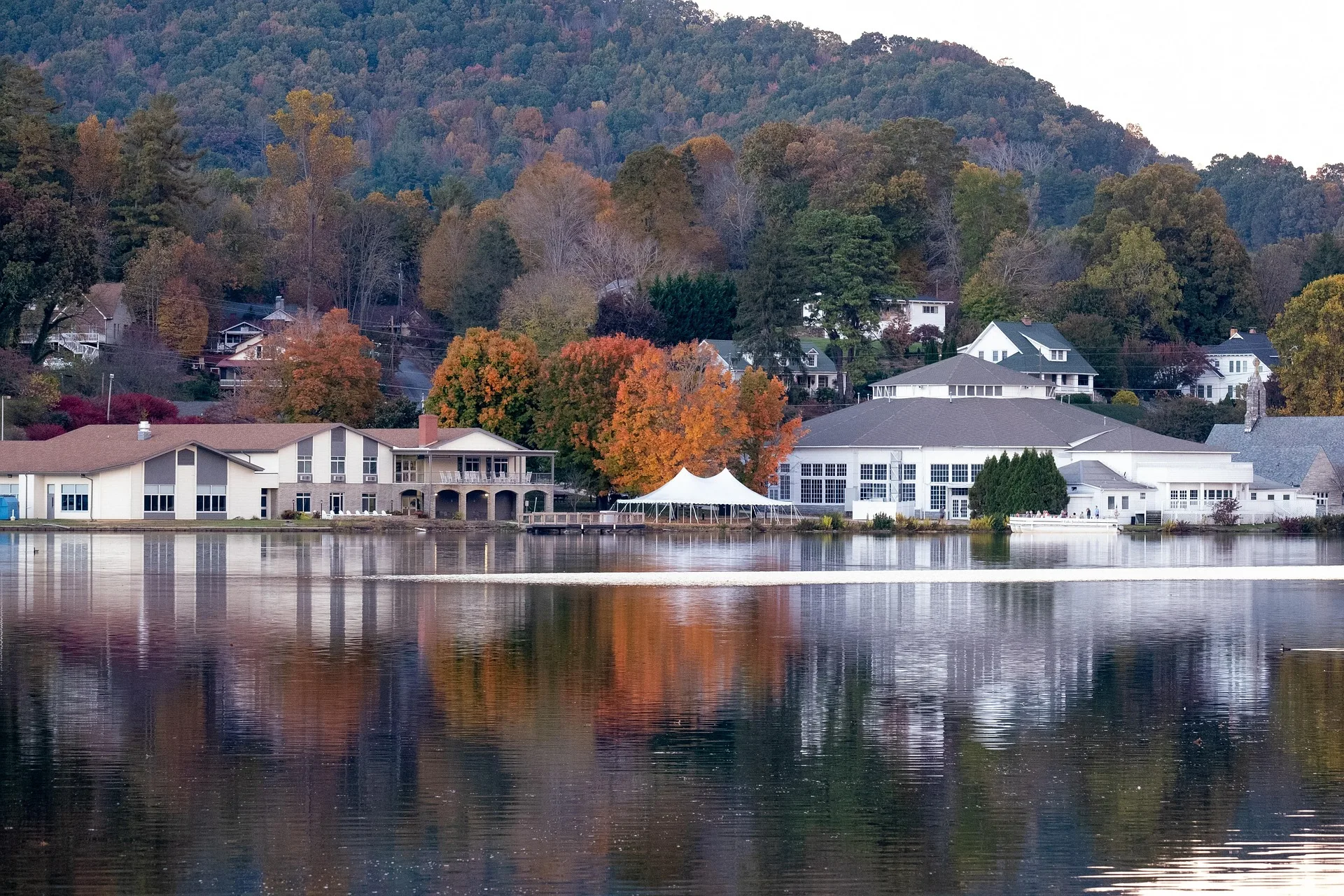
| October | 73 | 51 | 3.3 | Foliage season, first frosts late in month |
| November | 63 | 41 | 3.1 | Crisp, quiet, great hiking weather |
| December | 55 | 35 | 3.5 | Holiday lights on the water, lake starts dropping |
Winter (Dec-Feb)
Highs 52-57°F, lows 32-35°F
Coldest stretch, mild by northern standards. January is the most likely snow month and December is when Duke Energy starts the winter drawdown.
Spring (Mar-May)
Highs 64-80°F, lows 41-58°F
The sweet spot. Bloom peaks in April, the water crosses 70°F in May, and the boating season launches.
Summer (Jun-Aug)
Highs 87-90°F, lows 66-70°F
Hot, humid, and the busiest time on the water. Heat index runs 95°F to 100°F+ on the worst afternoons. August is wettest and peak hurricane season.
Fall (Sep-Nov)
Highs 63-83°F, lows 41-63°F
Locals' favorite. September holds summer water temperatures with autumn air, and October brings the foliage.
Source: NOAA National Centers for Environmental Information, 1991-2020 U.S. monthly climate normals for Charlotte Douglas International Airport (station USW00013881), via NWS Greenville-Spartanburg. Lake-shore readings can run a degree or two from the airport normals; these are planning numbers, not forecasts.
What is the water temperature in Lake Norman?
The surface temperature of Lake Norman follows a predictable arc: near 50°F in the dead of winter, crossing 70°F in May, peaking in the low to mid 80s in July and August, and holding summer heat well into September. These are typical seasonal averages from USGS-based lake temperature models and lake monitoring sources, not a specific buoy reading on a specific day.
For swimmers, the practical window is Memorial Day through late September. For boaters, prime season runs May through September, with July and August the warmest and busiest, and late May, September, and early October offering the best balance of comfortable water and smaller crowds. If you are weighing a boat purchase, the boat ownership cost guide has the full slip, storage, and insurance math.
| Season | Typical Surface Temperature | What It Means |
|---|---|---|
| Winter (Dec-Feb) | ~46-49°F | Too cold for swimming; the lake also drops 3 to 5 feet for the annual drawdown |
| Spring (Mar-May) | ~56°F in March to ~71°F in May | Wakes up fast; the first comfortable boating weekends come in May |
| Summer (Jun-Aug) | ~75°F in June, peaking ~82-86°F in July, ~84°F in August | Bathtub-warm swimming and the busiest boat traffic of the year |
| Fall (Sep-Nov) | ~79°F in September, ~69°F in October, ~57°F by November | September is the best swimming month: summer water, autumn air |
Winter
Dec-Feb
Too cold to swim, and the drawdown drops the lake 3 to 5 feet. See the winter drawdown guide.
Spring
Mar-May
The lake wakes up fast, and the first real boating weekends land in May.
Summer
Jun-Aug
Bathtub-warm and the busiest traffic of the year. July and August are peak.
Fall
Sep-Nov
September is the locals' secret: summer water with autumn air.
Where can you actually swim?
Most swimming around Lake Norman happens from docks, community beaches, and the handful of public access points, not a sandy lakefront beach. The swim guide covers the designated swimming spots, water quality, and what to check before you jump in.
What severe weather should Lake Norman residents expect?
The honest answer: no hurricanes at landfall strength, no storm surge, no blizzards, and no wildfire season, but yes to severe thunderstorms, spring tornadoes, and the occasional ice storm. The Piedmont sits in what meteorologists call Dixie Alley or the Carolina Alley, the secondary tornado zone east of the Great Plains, and severe storms can fire here any month of the year.
Spring is the peak window for tornadoes, and the ones that hit this part of North Carolina are usually short-lived and weak, mostly EF0 to EF2 on the Enhanced Fujita scale, though they can still down trees and damage roofs. Roughly 10% of North Carolina thunderstorms meet severe criteria, meaning hail of at least one inch or winds of at least 58 mph, per National Weather Service data. Damaging straight-line winds are actually the more common hazard than tornadoes, and they are the reason a big summer storm can leave a neighborhood littered with branches.
Winter brings a different beast: ice. Freezing rain is the main winter hazard in the Piedmont, and a quarter-inch of ice on trees and power lines is enough to snap limbs and knock out electricity, which is why local storm restoration firms treat ice damage as a territory-wide event across all four Lake Norman counties. Snow is usually a non-event here, but ice is not.
Summer is hot and humid enough to be its own hazard. The heat index regularly runs 95°F to 100°F+ on July and August afternoons, so outdoor plans on the water need a morning start and a shade plan. That is also why the cost of living guide budgets real money for air conditioning: lake homes run HVAC hard from May through September.
Does Lake Norman get hit by hurricanes?
Not the way the coast does. Lake Norman sits 150 to 200 miles inland, so the hazards are the remnants: heavy rain, gusty winds, flash flooding of creeks and the Catawba River basin, power outages, and debris in the water. There is no storm surge on an inland reservoir, and a landfalling hurricane usually arrives here as a strong tropical storm or a very wet rain event. Hurricane season runs June 1 through November 30, with the peak from August through October, which is why August shows up as the wettest month on the normals.
The story relocating buyers should actually know is Hurricane Helene in late September 2024, because it shows exactly how this lake behaves in a big rain. Helene dumped up to about 18 inches of rain on parts of the upper Catawba basin, and Duke Energy, which owns the dams and the shoreline, had pre-lowered Lake Norman to create storage. The result: Lake Norman itself rose only about three feet and briefly crested above its normal maximum, while the flooding went to the lakes with less storage, Lookout Shoals upstream rose roughly 12 feet and Mountain Island Lake downstream rose about 8 feet, flooding an estimated 170 to 260 structures in Mecklenburg County and triggering evacuations. On September 28, 2024, Duke opened four of the 11 gates at Cowans Ford Dam, the dam at the south end of Lake Norman, to move water through the system, a release that drew public frustration downstream. A similar major release in 2019 had previously been the largest in Lake Norman's history. After the storm, volunteers pulled tens of tons of debris off the lake itself.
The lesson for buyers is practical. A big storm is unlikely to flood your Lake Norman house from the lake side, but it absolutely can flood homes near feeder creeks and low shoreline lots when the basin fills. That is why the flood insurance guide is one of the first things I send relocating buyers, and why the Dock & Shoreline Guide explains the 760-foot line, the elevation Duke Energy manages the lake against, in detail.
Which Lake Norman county has the highest weather risk?
All four counties that touch Lake Norman, Mecklenburg, Iredell, Lincoln, and Catawba, share essentially the same storm climate, because weather does not stop at a county line. What differs is exposure, and that is where the FEMA National Risk Index is worth reading carefully. Mecklenburg ranks at the 97th percentile nationally for overall natural hazard risk, "Relatively High," with tornado risk around the 97th percentile and flood risk around the 99th, but that score is driven by population: about 1.1 million people and a dense built environment mean any given storm can do more damage in dollars. The other three counties score lower in absolute terms for the same reason, fewer people, fewer structures, smaller expected losses, not because the weather is kinder.
What matters for your house is the specific lot, not the county score. Lakefront communities in all four counties face locally elevated flood risk from the shoreline, feeder creeks, and the Catawba River basin, and flood mapping shows pockets of higher-risk ground right next to perfectly dry neighborhoods. The Four County Breakdown covers the tax and jurisdiction side of choosing a county; this is the one place where weather and county choice genuinely interact, so check the flood map before you fall in love with a lot.
| County | Lake Shore | FEMA Risk Index | What Drives It |
|---|---|---|---|
| Mecklenburg | Southeast shore (Cornelius, Davidson, Huntersville) | 97th percentile overall, "Relatively High"; flood ~99th | ~1.1M residents and dense built environment magnify expected losses |
| Iredell | East and northeast shore (Mooresville, Troutman) | Lower than Mecklenburg in absolute terms | Smaller population, lower expected dollar losses; same storm climate |
| Lincoln | Southwest shore (Denver, Westport) | Lower than Mecklenburg in absolute terms | Smaller population; shoreline and creek flood zones still apply |
| Catawba | Northwest shore (Sherrills Ford, Terrell) | Lower than Mecklenburg in absolute terms | Shoreline and Catawba River basin exposure; address-level flood checks matter |
Mecklenburg
Southeast shore
Cornelius, Davidson, Huntersville. "Relatively High" on FEMA's index, driven by population and built environment, not a worse climate.
Iredell
East / northeast shore
Mooresville, Troutman. Same storms, smaller expected dollar losses because of the smaller population.
Lincoln
Southwest shore
Denver, Westport. Quiet western shore with the same storm season; shoreline and creek flood zones still apply.
Catawba
Northwest shore
Sherrills Ford, Terrell. Shoreline and Catawba River basin exposure; check the exact address flood map.
Source: FEMA National Risk Index (riskbycounty.com summary, 2026) and NWS regional climate records. Mecklenburg's 97th-percentile overall score and its tornado and flood percentiles are documented; Iredell, Lincoln, and Catawba are described qualitatively because the index does not publish one tidy ranking for every county. All four counties share the same storm climate, so treat the difference as exposure, not hazard type.
Does it snow in Lake Norman?
Yes, occasionally, and barely. Charlotte averages about 3.5 inches of snow a year under the NOAA 1991-2020 normals, and January is the snowiest month at roughly 1.1 to 1.6 inches. Some winters record no measurable snow at all. The bigger winter story is ice: freezing rain is far more common than accumulating snow here, and a thin layer of ice does more damage to trees and power lines than a foot of snow ever would in the North.
Frost dates are what actually matter to people moving from warmer states who expect to garden year-round. The average last spring frost around Charlotte is about April 1 for a hard 32°F freeze and April 11 for a light 36°F frost, and the lake towns run a touch later, roughly mid-April. The average first fall frost arrives around late October, November 2 at the latest, giving the area about 199 to 215 frost-free days and USDA zones 7b to 8a. Translation: you can grow most everything, you just cannot plant tender things before mid-April.
Winter is also when the lake itself changes character. Duke Energy draws Lake Norman down 3 to 5 feet every winter for shoreline maintenance and storm storage, which is exactly why the winter water level guide tells waterfront buyers to see their cove in January before closing. A dock that looks deep in July can sit on mud in February.
| Winter Fact | Number | Source & Date |
|---|---|---|
| Average annual snowfall, Charlotte | ~3.5 inches | NOAA 1991-2020 normals |
| Snowiest month | January (~1.1-1.6 in) | NOAA 1991-2020 normals |
| Average last spring frost (32°F) | ~April 1; ~mid-April near the lake | NOAA normals; plantmaps.com |
| Average first fall frost (32°F) | ~Nov 2; late Oct near the lake | NOAA normals; plantmaps.com |
| Frost-free days | ~199-215 | NOAA normals |
| USDA hardiness zone | 7b-8a | USDA Plant Hardiness Zone Map |
Annual snowfall
NOAA 1991-2020
January is the snowiest month and some winters see none at all. Ice, not snow, is the real winter hazard.
Last spring frost
NOAA normals / plantmaps
Lake towns run slightly later, near mid-April. Wait until then to plant tender things.
First fall frost
NOAA normals / plantmaps
About 199-215 frost-free days a year, zones 7b-8a. A long, lush growing season.
What should a relocating buyer check before buying?
Weather does not usually change which town you pick, but it absolutely changes which lot and which house you should pick, so here is the checklist I walk relocating buyers through. First, pull the FEMA flood map for the exact address, not the neighborhood, because pockets of higher-risk ground sit right next to dry ones, and get a flood insurance quote before you negotiate, the flood insurance guide walks through zones and costs.
Second, if you are buying waterfront, see the property at winter drawdown level. The lake drops 3 to 5 feet from December into early spring, so a cove that looks deep in August can be too shallow for your boat lift in February, and the Dock & Shoreline Guide explains what Duke Energy will and will not let you do about it. Third, budget the HVAC reality: lake homes run air conditioning hard from May through September, and that shows up in the monthly utility line, which the cost of living guide prices out.
Fourth, if you can, visit in two seasons before you commit: once in late winter to see the drawdown and the bare shoreline, and once on a summer weekend to feel the heat and the boat traffic, because those are the two extremes that surprise people. Fifth, remember the storm season is short and manageable if your house sits on high ground and your trees are trimmed; the people who lose sleep over weather in Lake Norman are almost always the ones who bought a low lot on a feeder creek and skipped the flood map.
Common questions about Lake Norman weather
Does it snow in Lake Norman?
Rarely and lightly. The area averages about 3.5 inches a year under NOAA 1991-2020 normals, January is the snowiest month, and some winters see no measurable snow at all. Freezing rain and ice are the bigger winter hazards, since a thin ice coating damages trees and power lines more than accumulating snow.
Does Lake Norman get hurricanes?
The lake sits 150 to 200 miles inland, so it gets the remnants: heavy rain, gusty winds, flash flooding of creeks and the Catawba basin, outages, and debris, but no storm surge. In Hurricane Helene (September 2024) the lake rose only about three feet because Duke Energy had pre-lowered it, while smaller lakes upstream and downstream took the flooding.
Is Lake Norman in tornado alley?
It sits in the secondary tornado zone sometimes called Dixie Alley or the Carolina Alley. Spring is the peak window, and tornadoes here are usually short-lived and weak (mostly EF0 to EF2), but severe thunderstorms with damaging straight-line winds can fire any month of the year.
How hot does it get in Lake Norman in summer?
July averages a high near 90°F with overnight lows around 70°F, and the heat index regularly runs 95°F to 100°F+ on the worst afternoons because of the humidity. Air conditioning runs hard from May through September, which is a real line in the monthly budget.
What is the water temperature in Lake Norman in summer?
The surface peaks around 82 to 86°F in July and holds near 84°F in August, with June around 75°F. September is the locals' favorite swimming month because the water stays in the high 70s while the air cools off.
When is the best time to visit Lake Norman before moving?
Twice, if you can: late winter, to see the 3 to 5 foot drawdown and the true shoreline, and a summer weekend, to feel the heat and the boat traffic. Those are the two extremes that surprise relocating buyers, and seeing them before you buy is cheaper than discovering them after.
See the lake in all four seasons before you buy
I time my showings around the things that surprise relocating buyers: the winter drawdown, the summer heat, the wet spring weekends, and the golden October afternoons. Tell me which season you are moving in, and I will show you homes that look as good in February as they do in July.
Planning a move to Lake Norman?
Whether you are three months out or three years out, the county, town, and community questions come first, before any house tour. Tell me where you are moving from and what you are looking for, and I will point you to the right starting point in Lake Norman.