Lake History
Is Lake Norman man-made?
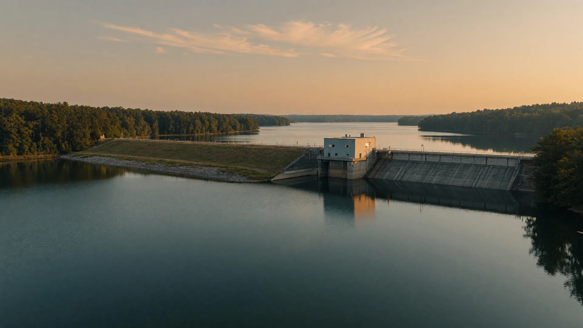
Yes, Lake Norman is man-made. It is a reservoir created by Duke Power (now Duke Energy) when Cowans Ford Dam was built across the Catawba River, and the lake reached full pond by June 1, 1963. It was built for hydroelectric power, which is why the same company still owns the lakebed and shoreline to this day, a fact that quietly shapes everything about buying a home in Lake Norman, from dock rights to property lines.
What kind of lake is Lake Norman?
Lake Norman is a man-made reservoir, not a natural lake. It is the largest man-made body of freshwater that sits entirely inside North Carolina, spanning roughly 32,510 acres, or about 50.8 square miles, across four counties: Catawba, Iredell, Lincoln, and Mecklenburg.
Construction started in September 1959 when Duke Power broke ground on Cowans Ford Dam, the first concrete was poured on September 1, 1960, and the water took about a year to fill behind the new dam. The lake was essentially full by June 1, 1963. In other words, every swim beach, every dock, and every waterfront yard in Lake Norman sits on land that was open river valley within living memory.
Lake Norman at a glance
Duke Power (now Duke Energy)
June 1, 1963
Catawba River
Norman Atwater Cocke
Sources: Wikipedia, Lake Norman; Visit Lake Norman FAQ; Levine Museum of the New South.
Why was a lake created here in the first place?
Lake Norman was built to make electricity, plain and simple. Cowans Ford Dam harnesses the Catawba River to spin the turbines of the Cowans Ford Hydroelectric Station, which is Duke Energy's largest conventional hydroelectric plant, with a nameplate capacity of about 350 megawatts. When the station opened in 1963 it was rated at 262,000 kilowatts.
The dam itself is no small structure. The U.S. dam inventory lists it at roughly 134 feet tall and about 8,738 feet long, an earthen and concrete embankment that holds back the Catawba for miles upstream. Beyond power generation, the reservoir also provides cooling water for nearby power plants, which is part of why the lake's level is managed so carefully all year.
Cowans Ford Dam Quick Stats
about 134 ft
about 8,738 ft
about 350 MW
Catawba-Wateree No. 2232
Sources: Wikipedia, Cowans Ford Hydroelectric Station; Duke Energy Illumination; US Dam Inventory via Dams of the World.
Who built Lake Norman, and who owns it today?
Duke Power built the lake, and the lake is named after the man who championed it: Norman Atwater Cocke, a lawyer who served as president of Duke Power from 1953 to 1959. Cocke was central to planning the dam and the reservoir, and the lake carried his name from the start.
Today Duke Energy owns the lakebed and the shoreline, a point that matters far more than most relocating buyers realize. The lake operates under the federally regulated Catawba-Wateree Hydroelectric Project (FERC Project No. 2232), which is why Duke Energy controls the water level all year. On the lake's gauge, 100.0 feet means full pond, which corresponds to an actual elevation of roughly 760 feet above sea level.
That 760 line is the single most important number in Lake Norman waterfront real estate. Your property line ends at the 760-foot full-pond elevation, not at the water's edge, and everything below it belongs to Duke Energy. For the full breakdown of what that means for docks and permits, see our Dock and Shoreline Guide.
What was here before the lake filled in 1963?
The water didn't rise over empty land. Duke Power acquired roughly 700 parcels ahead of the flood, much of it fertile family farmland, and whole communities were covered when the Catawba valley filled.
No incorporated town went under, but there were genuine communities lost. Long Island was a milling town with its own mill village and the Long Island Mill, a textile mill with roots back to the 1850s, and the East Monbo Mill Village disappeared too. About 50 families lived in Long Island's mill village alone, and mill workers were offered their homes for free if they paid to move them above the flood line. Some houses were jacked up and literally rolled to higher ground.
The losses weren't just buildings. About 27 miles of roads were taken out or relocated, bridges including the old NC 150 crossing were replaced, and Duke Power moved seven family cemeteries plus a single grave. One 1820s plantation house called Elmwood, built by John Davidson Graham on a 1,200-acre cotton plantation, now sits under the water. Today you can boat across what used to be people's front yards.
Sources: Levine Museum of the New South; Davidson Historical Society; Lake Norman Publications, Life Before the Lake; LakeHomes, What Lies Beneath.
How big, how deep, and which counties does Lake Norman touch?
The size is easy to picture once you break it down. Here is the full picture, with every number attached to its source and date below the table.
| Metric | Number | What it means |
|---|---|---|
| Surface area | 32,510 acres (about 50.8 sq mi) | Largest man-made lake fully inside North Carolina |
| Shoreline | about 520 miles | Some sources count up to 538 miles along coves |
| Maximum depth | about 112 ft | Found near Cowans Ford Dam at the southern end |
| Average depth | about 33 ft | Plenty deep for boating in the main channel |
| Counties | Catawba, Iredell, Lincoln, Mecklenburg | Four counties, four tax rates, five school systems |
Surface area
32,510 acres (about 50.8 sq mi)
Largest man-made lake fully inside North Carolina.
Shoreline
about 520 miles
Some sources count up to 538 miles along coves.
Maximum depth
about 112 ft
Found near Cowans Ford Dam at the southern end.
Average depth
about 33 ft
Plenty deep for boating in the main channel.
Counties
Catawba, Iredell, Lincoln, Mecklenburg
Four counties, four tax rates, five school systems.
Measurements are approximate and vary slightly by source. Lake surface and shoreline from Visit Lake Norman FAQ and Wikipedia (accessed October 2026). Depth figures from Wikipedia's Lake Norman article and LakeInsights (accessed October 2026).
Why the man-made part matters when you buy in Lake Norman
This isn't a trivia fact, it is the most relevant detail about Lake Norman for anyone buying here. A reservoir built for power is run like a power facility, and that governs the shoreline, the water level, and even the county you pay taxes to.
| The fact | Why it matters when you buy |
|---|---|
| Duke Energy owns the lakebed and shoreline | Your property line ends at the 760-foot line, not the water's edge. Dock rights are granted, not assumed. |
| The lake is a FERC-regulated reservoir | Duke Energy sets the seasonal water level, and every winter the lake is drawn down on purpose. |
| Four counties touch the same water | Catawba, Iredell, Lincoln, and Mecklenburg each set their own property tax rate. That is a four-figure difference per year. |
| The land beneath was river valley | Old farm roads, foundations, and timber can lurk under coves. Depth varies wildly from one cove to the next. |
Duke Energy owns the lakebed and shoreline
Your property line ends at the 760-foot line, not the water's edge. Dock rights are granted, not assumed.
The lake is a FERC-regulated reservoir
Duke Energy sets the seasonal water level, and every winter the lake is drawn down on purpose.
Four counties touch the same water
Catawba, Iredell, Lincoln, and Mecklenburg each set their own property tax rate. That is a four-figure difference per year.
The land beneath was river valley
Old farm roads, foundations, and timber can lurk under coves. Depth varies wildly from one cove to the next.
Shoreline and dock rights
Owning waterfront does not automatically mean you can build a dock, modify one, or keep an existing one if it breaks the rules. Duke Energy's Shoreline Management Program governs all of it. There is a real difference between dockable and non-dockable waterfront value.
Dock & Shoreline GuideWater levels all year
Because the lake is a power reservoir, the level drops every winter to make room for spring runoff. Buyers who never account for it get surprised when their dock sits on dry bank in February.
Why the lake drops in winterFour counties, four tax bills
The same reservoir is governed by four county governments on four different shores. Which county you land in sets your taxes and your school district, so county choice matters before you ever tour a house.
Four County BreakdownFrequently asked questions
Is Lake Norman man-made or natural?
Lake Norman is man-made. Duke Power (now Duke Energy) created it by building Cowans Ford Dam across the Catawba River, and the reservoir is the largest man-made body of freshwater located entirely within North Carolina. Source: Wikipedia, Lake Norman; Visit Lake Norman FAQ.
When was Lake Norman built?
Construction on Cowans Ford Dam began in September 1959, the first concrete was poured on September 1, 1960, and the lake reached full pond by June 1, 1963. Source: Levine Museum of the New South; Davidson Historical Society.
Why is it called Lake Norman?
Lake Norman is named for Norman Atwater Cocke, a lawyer who served as president of Duke Power from 1953 to 1959 and played a central role in planning the dam and reservoir. Source: Wikipedia, Lake Norman.
Who owns Lake Norman?
Duke Energy owns the lakebed and the shoreline up to the 760-foot full-pond line. The lake operates under the federally regulated Catawba-Wateree Hydroelectric Project, FERC Project No. 2232. Source: Duke Energy; Wikipedia, Lake Norman.
Was a town flooded to create Lake Norman?
No incorporated town was submerged, but real communities were covered, including the milling town of Long Island and the East Monbo Mill Village, along with farms, roads, and seven family cemeteries that Duke Power moved. Source: Levine Museum of the New South; Lake Norman Publications.
How deep is Lake Norman?
Lake Norman reaches a maximum depth of about 112 feet near Cowans Ford Dam at the southern end, with an average depth of about 33 feet across the lake. Source: Wikipedia; LakeInsights.
Thinking about a waterfront home in Lake Norman?
I have spent more than 22 years selling homes in Lake Norman, and the man-made history of this lake shapes every waterfront deal I touch. Let me help you understand dock rights, shoreline rules, and your true tax picture before you make an offer.
Planning a move to Lake Norman?
Whether you are three months out or three years out, the county, town, and community questions come first, before any house tour. Tell me where you are moving from and what you are looking for, and I will point you to the right starting point in Lake Norman.